
The beautiful views along the Klint Road
Take time to explore Estonia’s northern coast, where the limestone cliffs and waterfalls of the Baltic Klint offer magical views and new adventures.
Exploring Estonia's coastal cliffs
A trip along the Klint Road takes you from Estonia’s oldest national park, Lahemaa, to its newest one, Alutaguse National Park.
The Northern Estonian Klint is a coastal escarpment along the Gulf of Finland. It forms part of a large natural phenomenon stretching from Lake Ladoga in Russia to the Swedish island of Öland. This journey begins in Tallinn, covering around 500 km, and highlights the diversity of Estonian nature in all its glory: primeval forests, waterfalls, lakes, beaches, historic manors, and sleepy fishing villages.
The route is colorful in autumn, enchanting in winter, blossoming in spring, and vibrant in summer. It offers you the opportunity to experience the character of the Virumaa region in every season.
What to expect:
- Main attractions: The Klint Road highlights 10 hidden gems worth exploring, as well as manors, museums, parks, lakes, beaches, fishing villages, and luxurious spas.
- Total length: About 500 kilometers
- Duration: Aim to take things slowly and plan at least three days exploring the route.
- Season: Year-round, as there are spectacular displays of color in autumn and the frozen waterfalls in winter are especially magical at sub-zero temperatures with northerly winds.
- How to get here: The Klint Road is traversable by bike or car, or by public transport.
- Green travel tips: Below, we recommend local service providers who have been awarded a green label and can be found on or close to the Klint Road. The most sustainable way to travel is by hopping on a bike — you will enjoy the most amazing views from smaller byways, which are perfect for traveling on two wheels. The journey bypasses larger towns, allowing you to enjoy the beauty of nature. You can also use public transport to get to many places along the route.
- Where to start: Tallinn is a good place to start and end.
If you would like to hear exciting local stories along the Klint Road, take a local guide with you – see Lahemaa guides and Ida Viru County guides.
From Tallinn to Käsmu
Exploring a national park and coastal villages
Start your journey at Jägala Waterfall. This is Estonia’s widest natural fall, with water cascading from a limestone cliff nearly 8 meters above the Jägala River, then spreading out to a width of 50 meters. This impressive sight is located in Harju County, just a 30-minute drive from Tallinn.
Next, head to Lahemaa, Estonia’s oldest and largest national park. Here, you will find forest trails, stunning bogs, charming coastal villages, and historic manors. It's an ideal place for hikers and birdwatchers, offering authentic experiences in a natural setting that has remained largely untouched by humans.
Cape Purekkari is the northernmost point on the mainland of Estonia. The cape is characterized by its harsh beauty, with a rocky coastline, boulders polished by the Baltic waves, and low-lying scrub that defies the wind and salty sea air.
One of the gems of Lahemaa is Käsmu, a former captains' village overlooking the Gulf of Finland. You can walk along the seashore here, visit the quaint maritime museum, and soak up the atmosphere among its Ice Age-era boulders. In a beautiful pine forest at one end of the village lies Northern Europe’s largest boulder field, covering 400 hectares. Hiking and cycling trails criss-cross the Käsmu peninsula.
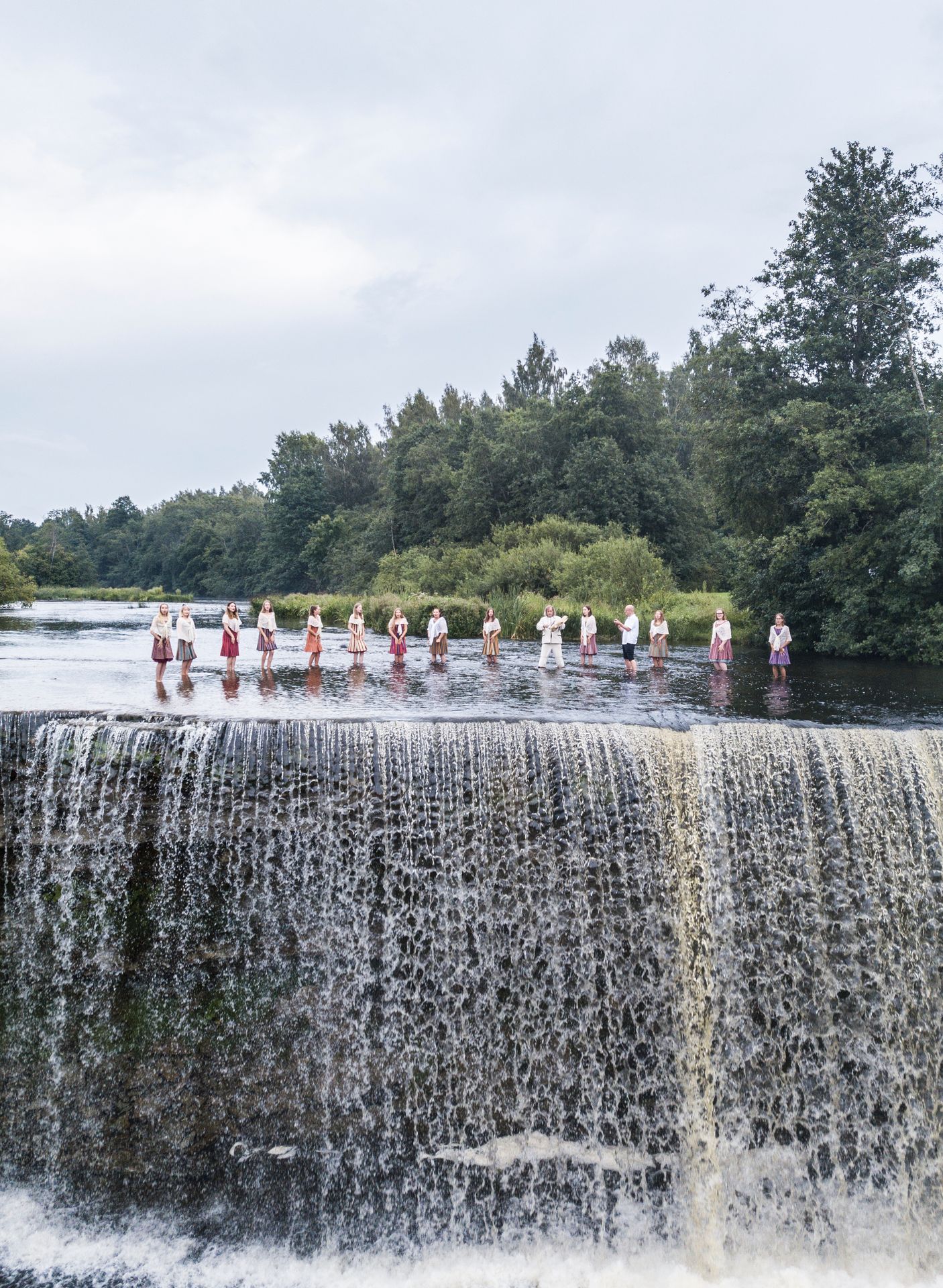
Photo author: Alari Teede
From Oandu to Toolse Order Castle
Up-close-and-personal with Estonia's nature and history
Next, head to Oandu, Lahemaa National Park and Nature Centre, where you can walk along well-marked hiking trails in the forest and learn about the formation of the limestone cliffs and the region’s biodiversity.
Sagadi Manor combines history and nature education. This beautiful 18th-century manor, with its interactive forest museum, beautiful park and delightful arboretum, offers opportunities for learning, recreation, and overnight stays. Continue your journey eastwards, where you will enjoy enchanting views from the cliff tops.
Toolse Order Castle is the northernmost and the "youngest" castle of its kind in Estonia. It is thought to have been constructed in the 14th century to protect the local harbor and ward off pillaging pirates. Its stone walls, which once served a defensive purpose, now offer space and tranquillity, making it the perfect place to take a break and gaze at the sea.
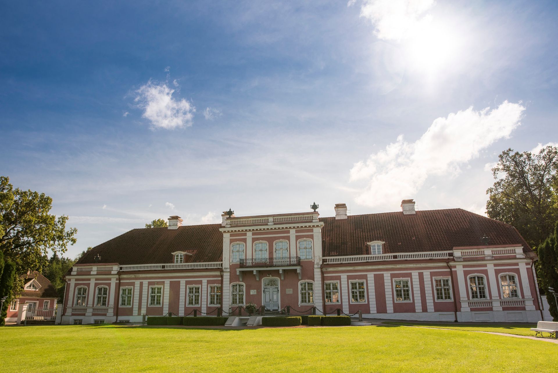
Photo author: Tanel Murd
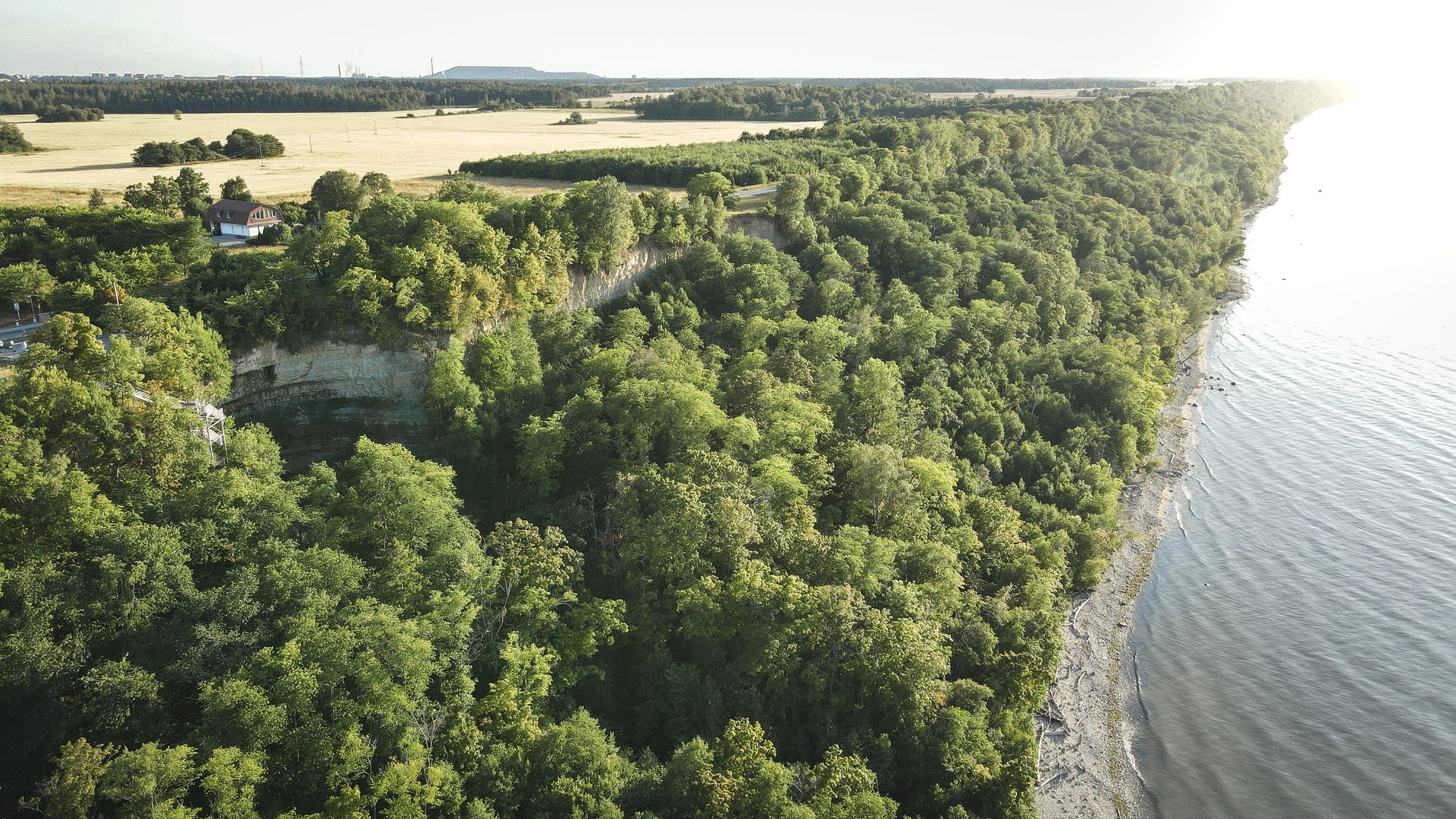
Along the coast from Lahemaa to Toila
Exploring the majestic cliff-lined coast
Once you have left the winding roads of Lahemaa behind, you will be greeted by panoramic sights of North Estonia’s limestone cliffs, which make up part of the Baltic Klint. These towering natural structures feature powerful waterfalls that have shaped the landscape over the centuries. The park at Saka Manor, which stands on the cliff's edge, is home to the cascading Kivisilla Waterfall. In spring, when the waters flow and the vegetation becomes lush, the falls are like something out of a jungle adventure.
The North Estonia Klint rises to its highest point at Ontika, where the highest cascades in Estonia – Valaste Waterfall – are located. With a drop of 32 meters, this natural wonder is impressive in any season. It is here that you will enjoy the best cross-section views of this 480-million-year-old cliff.
The road passing above is a former postal route that was once traveled by presidents and royalty. The same road will lead you to Oru Park, which was once home to Oru Castle: the summer residence of Estonia’s first president, Konstantin Päts. Today, you can experience the castle’s glory via a virtual journey through time called "VR Toila 1938."
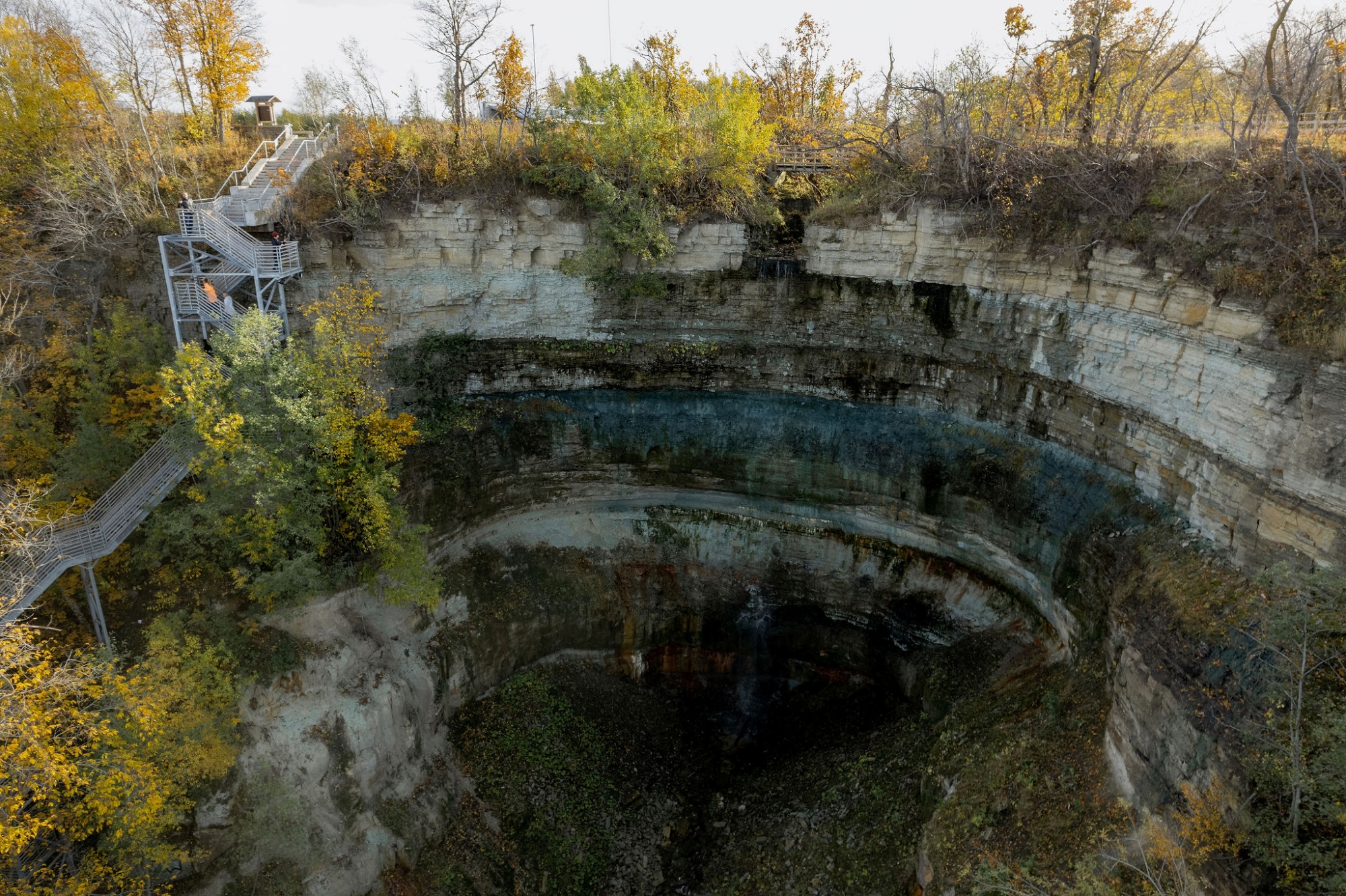
Photo author: Valmar Voolaid
Heading inland and back to Tallinn
Estonia's newest national park and an underground river
From here, it is worth heading to Alutaguse National Park, Estonia’s youngest national park – and one of the wildest areas in the country. It is known for its sprawling forests, tranquil bogs, and inland sand dunes, known as kriivas (the remnants of river bends). More than half of Estonia’s brown bears live in the forests of Alutaguse. This is also the only region in Estonia where rare flying squirrels are found. The national park is bordered by Lake Peipus and the Narva River. The Alutaguse Visitor Center outlines the history of the region, while the Luite hiking trail, which starts just outside, takes you deep into the forest and directly to the shores of Lake Peipus.
Once your journey turns back towards Tallinn, you will find Emumägi Hill along the route. This is the highest peak in the Pandivere Uplands and, in fact, the highest peak in Northern Estonia as a whole. A total of 115 steps lead up from the foot of the hill to its peak at 80 meters, but the effort is worth it, since on a clear day you will enjoy views for as far as 20-30 kilometers.
The last stop on the Klint Road is the Kostivere karst area, whose uneven surface conceals the mysterious Jõelähtme underground river. This landscape makes for a fitting conclusion to a journey along the cliffs, with its rich natural and cultural treasures.
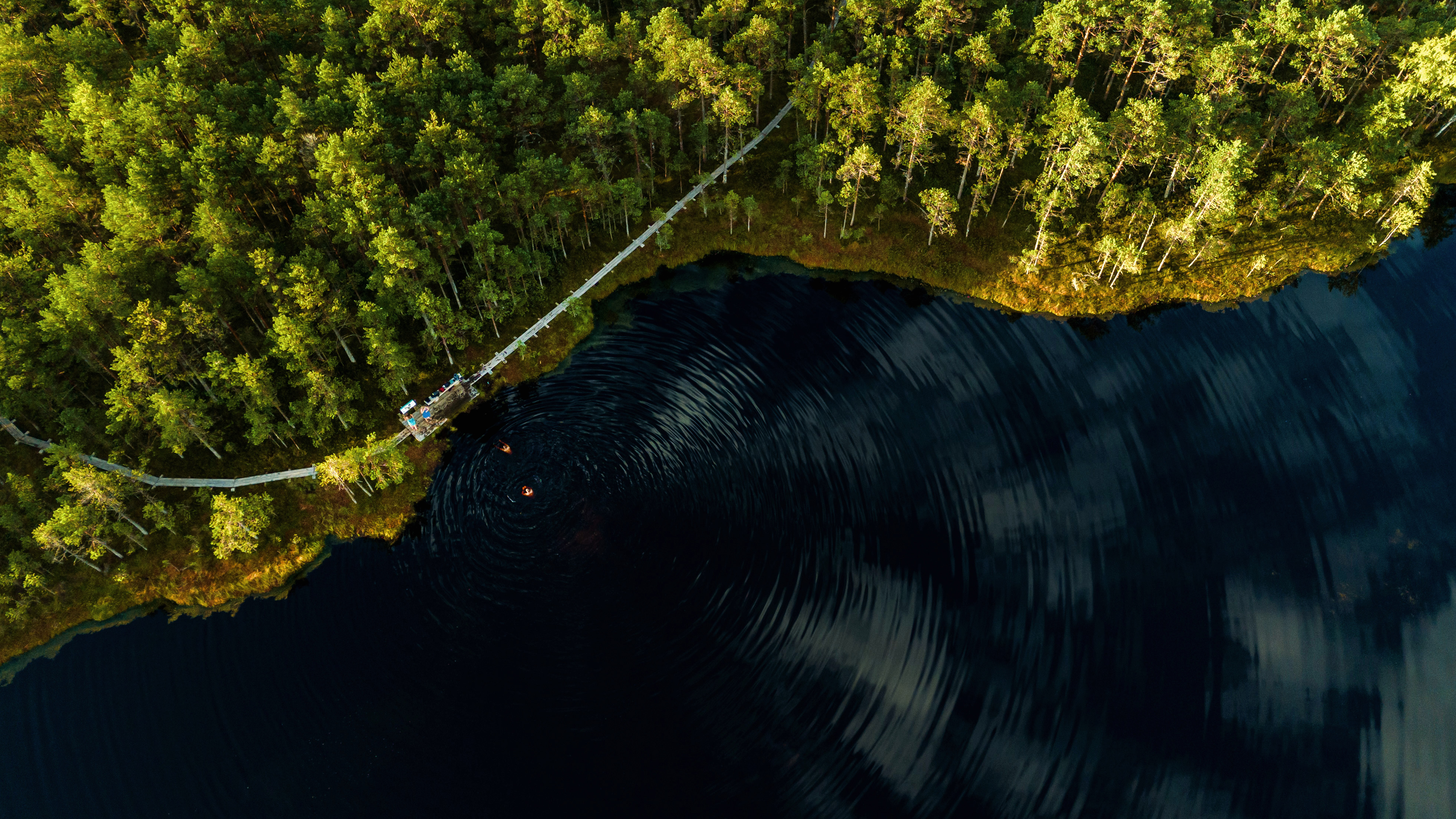
Photo author: Sören Talu
Every stop brings you closer to the true essence of nature in the Virumaa region.
These places represent the crème de la crème of the Klint Road. However, there are other interesting places along the route, and a full map is available to help you on your journey.
The Klint Road offers a unique way to explore of the mighty limestone coast of North Estonia, showcasing the full diversity of the country’s nature.
Come and discover it for yourself!
Must-see stops along the Klint Road

Get inspired
Last updated
28.08.2025